Bare Feet Walking Tour Rudlbach

Val Casies Valley - Monguelfo - Tesido
Add to favourites
Difficulty
Easy
Duration
2:00
in hours
Distance
1.6
in km
Suggested period
Jan
Feb
Mar
Apr
May
Jun
Jul
Aug
Sep
Oct
Nov
Dec

Bare Feet Walking Tour in Tesido

Starting point: Tesido parking in Prati di Tesido
Duration: 02:00 h
Difference in altitude:
150 m

Route data
Easy
Distance
1,6 km
Duration
2 h 00 min
Ascent
122 m
Decent
122 m
Technical skills
Physical condition
Scenary
Highest point
1.373 m
Lowest point
1.400 m
Directions
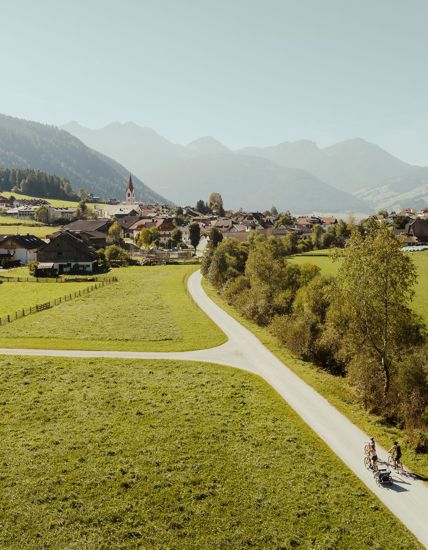
This special hike, where you don’t even wear shoes, is a fun adventure for the ones who love unusual experiences. Walking barefooted through the woods, over pastures and through the cold, chrystal clear water you will create a strong bond with nature.  Pull off the socks and jump right into the fresh water. Parking area right beside the path.
How to get there
Coming from Innsbruck/Brennero (A): Drive on the Highway of Brennero (A22) until the exit Bressanone/Val Pusteria, then go on along the SS49-E66 for about 58kms until you arrive in Monguelfo. To get to Tesido, we recommend to take the exit West in Monguelfo. Coming from Lienz (A): You can reach us also padding by Lienz in Westtyrol (A). You have to cross the Austrian-Italian border between Ahrnbach and Winnebach (B100-E66) and drive on the SS46-E66 until Monguelfo. To get to Tesido, we recommend to take the exit West in Monguelfo.
You might be interested in
Discover related tours
Dolomites view | © Tourismusverein  Antholzertal, Tourismusverein Antholzertal
Intermediate
Add to favourites
Val Casies Valley - Monguelfo - Tesido
Dolomites panoramic view tour
Distance 9,1 km
Duration 2 h 58 min
Ascent 555 m
Decent 555 m
Status
closed
Randlhütte–Hinterschuher Alm | © TV Gsieser Tal_Kamilla Photography, Gsieser Tal–Welsberg–Taisten
Intermediate
Add to favourites
Val Casies Valley - Monguelfo - Tesido
Hiking tour to the Hinterschuher Alm-Randlhütte (1862m)
Distance 4,1 km
Duration 1 h 58 min
Ascent 585 m
Decent 0 m
Val Casies Valley - Monguelfo - Tesido
Hiking tour to the Bonner Hütte (2340m)
Distance 10,2 km
Duration 4 h 43 min
Ascent 1.380 m
Decent 353 m
Val Casies Valley - Monguelfo - Tesido
Circular trail „zu Adlitzhausen“
Distance 3,4 km
Duration 56 min
Ascent 79 m
Decent 79 m
Mount Dura | © TV Antholzertal, Tourismusverein Antholzertal
Intermediate
Add to favourites
Val Casies Valley - Monguelfo - Tesido
Mount Dura
Distance 5,0 km
Duration 3 h 30 min
Ascent 1.172 m
Decent 0 m
Status
closed
Val Casies Valley - Monguelfo - Tesido
Winter walking tour to the mountain hut Messner Hütte in S. Maddalena
Distance 3,0 km
Duration 50 min
Ascent 200 m
Decent 0 m
Status
closed